Thompson Falls Eastward Extension Trail
This is a collaborative project with Thompson Falls Community Trails to build an accessible pedestrian path along Hwy 200 in Thompson Falls so that people may safely and freely walk, bike, or roll from one side of town to the other.
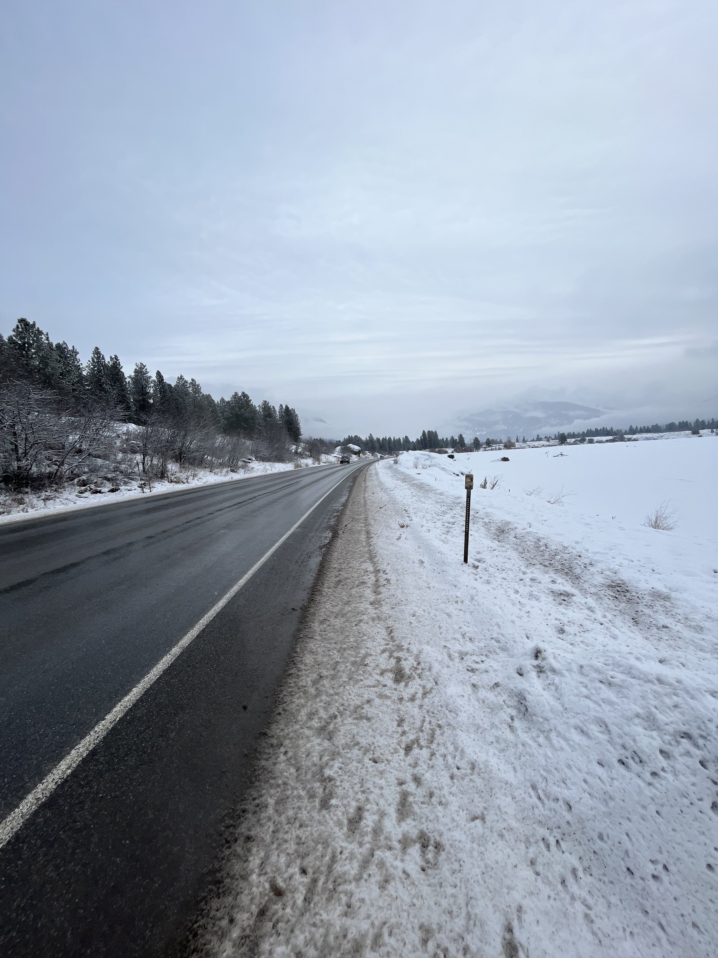
There is currently no safe pedestrian path between the two disparate ends of Thompson Falls - the west/downtown side and the east/commercial side with our only grocery store. This section of highway is very dangerous for those without cars - there is no shoulder and very little right-of-way. Not only is this a safety issue, but also a socioeconomic issue; only those with vehicles can readily travel across town.
Check out the information and pictures below to learn more about the project:


Thompson Falls Trails Plan
2014 (updated 2018)
The Trails Plan for Thompson Falls is a guideline for trail construction, maintenance, and new trail opportunities. It was created by the Thompson Falls Community Trails, a local nonprofit whose goal is to enhance quality of life in the Thompson Falls area of Sanders County, Montana, by building, maintaining, and improving trails that provide transportation ways, connectivity, and recreation opportunities. The Eastward Extension Trail project can be seen on page 6 within the project list table.
Downtown Master Plan
2015
The Thompson Falls Downtown Master Plan was created by the Downtown Committee (now known as Thompson Falls Main Street) with the City of Thompson Falls and local residents. The plan contains goals and actions for the betterment of the community, and trail projects can be found under “Amenities.” The Eastward Extension Trail and improvements to Wild Goose Landing can be found on pages 34-40 under the Amenity Actions (1.2c, 1.3b, 1.3c, 1.3d, 1.3e).
Community Action Plan
2020
The Thompson Falls Community Trail Map shows the non-motorized trails the committee helps maintain. Eastward Extension Trail is not yet on the map, but Powerhouse Loop Trail, State Park Trail, Mule Pasture Trails, and other recreation opportunities are shown.
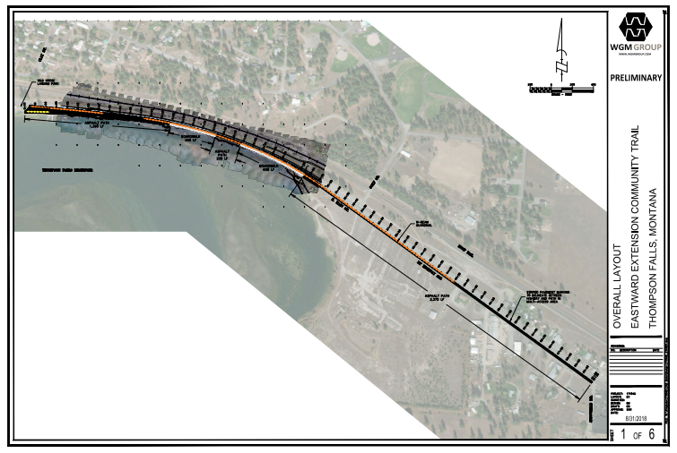
An engineering team, WGM Group, conducted a study of the possible strategies to implement a safe pedestrian path from Wild Goose Landing to Harvest Foods. This team contacted the various agencies with jurisdiction along the route, and documented the most feasible options. This study is greatly influencing our progress forward on this project.
Project Documents
The Community Action Plan was created during the Recreation Economy for Rural Communities workshop in Thompson Falls. This action plan created goals related to outdoor recreation in the area. The 2nd goal of the plan is to identify needs for connective infrastructure among recreation assets and downtown, and action 2.1 is Based on existing plans and studies, identify the specific next steps needed to make Main Street safer and more attractive for pedestrians and cyclists (page 21).
TFCT Trail Map
2017
Feasibility Study
2018